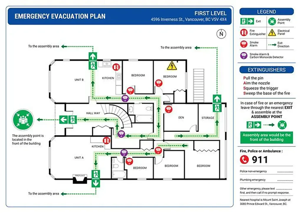
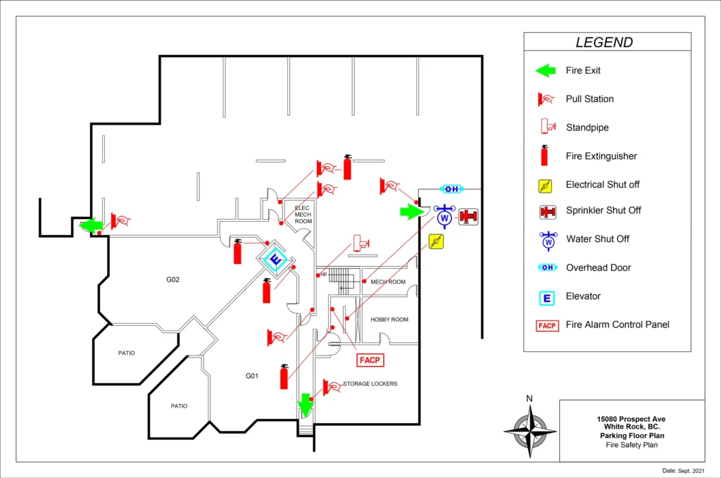
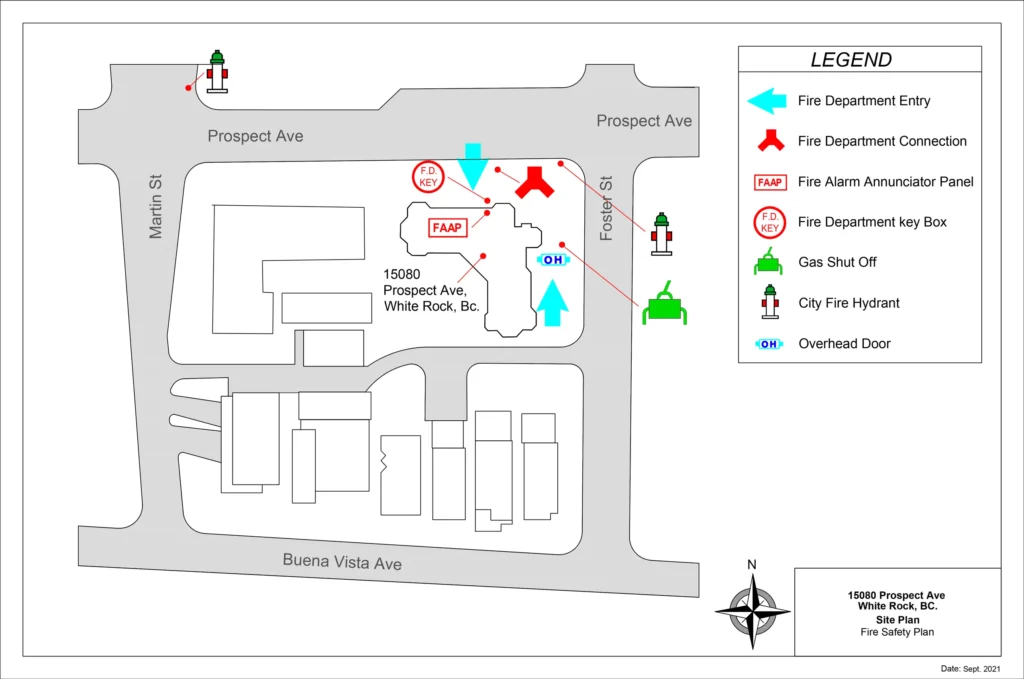
Fire Evacuation Plan
Our array of samples is here to inspire.
Select the ones that align with your style and preferences.


1. What you provide us:
- One of following files:
- Sketch
- Blueprint of your floorplan
2. What you receive:
- Product Specification:
- As per sample
Deliverable:
- 2K or 4K Resolution image (JPEG or PNG) with your Logo
- PDF or Dwg Format
3. Turnaround time:
Importance of Evacuation Plan
Evacuation maps play a crucial role in emergency preparedness and response. They are essential tools for guiding people to safety during disasters or emergencies, such as natural disasters, industrial accidents, or other events that may require evacuation. Here are several reasons why evacuation maps are important:
1. Navigational Guidance:
Evacuation maps provide clear and concise information about evacuation routes, assembly points, and important landmarks. This helps individuals navigate safely from their current location to designated safe zones or evacuation centers.
2. Emergency Preparedness:
Having well-designed evacuation maps in public spaces, buildings, and communities enhances overall emergency preparedness. People are more likely to respond effectively during an emergency when they are familiar with evacuation procedures and routes.
3. Public Awareness:
Evacuation maps raise awareness about potential hazards and the need for evacuation in specific areas. This knowledge can empower individuals to make informed decisions and take necessary actions in the event of an emergency.
4. Efficient Evacuation:
During a crisis, time is often of the essence. Evacuation maps can help streamline the evacuation process by providing easily understandable information, reducing confusion, and promoting a more organized and efficient evacuation.
5. Communication:
Evacuation maps serve as a form of communication between emergency management authorities and the public. Clear and well-placed maps can convey critical information quickly and effectively to a large number of people.
6. Accessibility:
Evacuation maps should be easily accessible to everyone, including individuals with disabilities. They should be designed with clear symbols, easy-to-understand language, and consideration for diverse needs to ensure that everyone can use them.
7. Emergency Response Coordination:
Evacuation maps also aid emergency responders by providing a visual reference for planning and coordinating their actions. These maps help responders understand the layout of an area, potential hazards, and the most efficient routes for evacuation.
8. Community Resilience:
By promoting awareness and preparedness, evacuation maps contribute to building a resilient community that can better withstand and recover from emergencies. Well-prepared communities are more likely to respond effectively and recover more quickly.